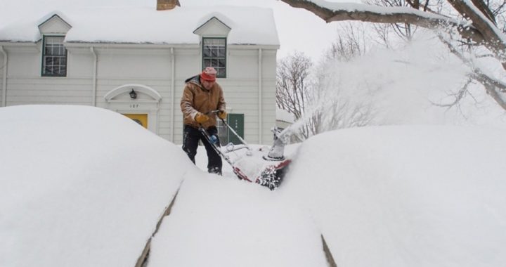
As the old saying goes, March of 2019 is expected to hit the United States like a lion — a really big and angry lion. Colder-than-normal temperatures are expected in most of the lower 48 states in the coming week as more Arctic air is set to plunge into America starting as early as today.
From the National Weather Service: “Below normal temperatures will prevail across the Northern/Central Plains and Upper Midwest through the end of the week (and beyond). On Thursday, high temperatures of 15-30 degrees below average are expected for much of the Plains and into the Upper/Middle Mississippi Valley. Temperatures of 20-40 degrees below average are forecast for the Northern Plains on Friday and Saturday morning after another cold front passes through.”
Temperatures have already been below normal for much of the past week in Montana, the Dakotas, Minnesota, and Wisconsin. And it’s about to get colder. The Arctic blast is unusual for this late in the winter and the reach of it is also abnormal. Lower than normal temperatures are forecast for almost the entire lower 48 states with the possible exceptions of Florida, Georgia, and South Carolina.
It’s more cold weather in March for many areas that have experienced an extremely cold February. Great Falls, Montana, is currently running 27 degrees below normal for February. And long-term forecasts show no end for the persistent cold pattern any time soon.
In addition to the cold, Accuweather reports that a series of winter storms is expected to bring snow, rain, and possibly freezing rain into the Northeast, which will then be followed by unusually cold weather.
The largest storm is expected to hit sometime on Sunday with cities as far-flung as St. Louis, Cleveland, Louisville, and Philadelphia in its sights. The entire weather system is expected to affect an area from Northern Illinois to the Gulf of Mexico.
And it’s not just east of the Rockies where the weather has been unusually cold. Los Angeles is currently experiencing its coldest February since 1962.
The Los Angeles Times reported: “This month is the coldest February in downtown Los Angeles in nearly 60 years, with the average high of 60.6 as of Sunday [February 24]. That’s a full 8 degrees below the normal average high temperature.”
According to the historic temperature data, 2019 has been the fourth coldest February of all time in the Los Angeles area.
On February 20, snow was reported in portions of the Los Angeles area. Although there was no accumulation, the sight of snow in the city of Los Angeles is extremely rare. The last time it was reported was in 2011.
It’s been a cold and (thankfully) wet winter in much of California, where out-of-control wildfires have been raging in parched forest and chaparral areas of the state in recent years. This week, more wet, chilly weather is hitting the state as an Atmospheric River is currently dumping even more rain on the state.
But, unfortunately, the rain is not all good news in the Golden State. In northern portions of the state affected by last year’s wildfires, rainfall totals of 6-12 inches in mountainous areas bring the possibility of mudslides.
If those mudslides occur, how long will it be until some enterprising climatologist blames them on climate change?
These weather events are interesting because they’re unusual. But anomalies like these are in the very nature of weather and, by extension, climate. They’re not proof of anything — not of a coming glaciation and certainly not of global warming. But while climate realists know that unusual weather occurs; climate alarmists will look to attribute any unusual weather event to so-called climate change. It’s infuriating, but that’s the nature of their politics — not their science.
The climate is changing — it always has and will always continue to do so — naturally, as God intended.
Photo of winter weather in Minn., Feb. 20, 2019: AP Images


